Day 4: Darnaway
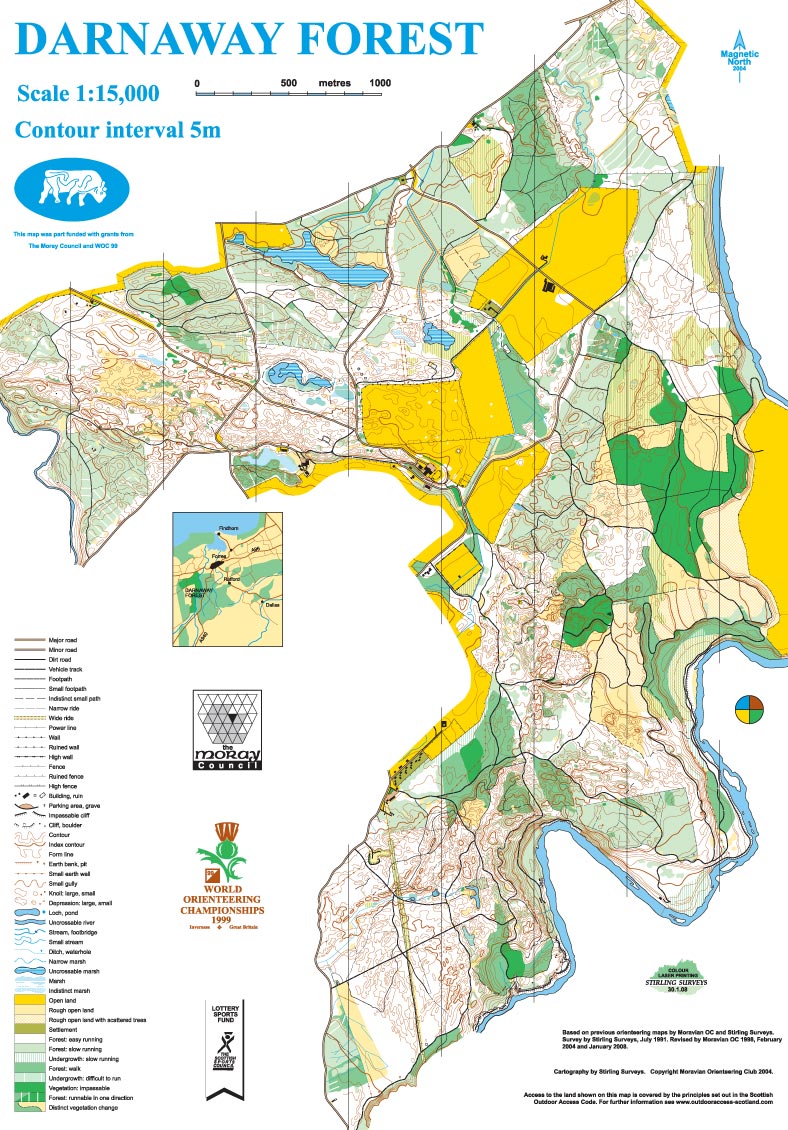
Darnaway map
Thursday 6th August
Photo galleries: ActivNorth, Wendy Carlyle
Location

Nearest town: Brodie
- Postcode: IV36 2SW
- Lat/Lon: 57.59138,-3.68451
- Google Map
- Streetmap (OS)
- Bing Map (OS)
- OpenStreetMap
Darnaway is an extensive, well-managed forest with great variety.
Darnaway has been used for previous WOC and Scottish 6 Days events, including the first event in 1977. It has superb, varied forest on rolling terrain above the River Findhorn. The majority of the area is owned by Moray Estates, the estates and property of the Earl of Moray.
Organising clubs: Interløpers Orienteering Club (INT), Clydeside Orienteers (CLYDE), Solway Orienteers (SOLWAY), Edinburgh University Orienteering Club (EUOC), with Cleveland Orienteering Klub (CLOK)
Day Organisers: Andrew MacPherson (CLYDE), Robin Orr (CLYDE)
Planners: Pete Lawrence (GRAMP), Ian Searle (GRAMP)
Assistant Controller: Graeme Ackland (INT)
Controller: Eddie Harwood (MOR)
Travel: Please follow these travel directions to reach the event. There may be other possible routes but this is the route agreed with local police and other relevant official bodies.
From Inverness, follow A96 for 23 miles through Nairn and just beyond Brodie. Turn R onto minor road signed Whitemire/Conicavel. Follow O signs onto Estate tracks to parking field.

Distances between locations
Parking: In fields adjacent to Race Arena. A one-way system is in place, ensuring different entry and exit routes. Buses and campervans are in the same area.
No exit before 12:30.
Race Arena: A large open field, directly north of Darnaway Castle. The Arena is shared with WOC, but there is ample space for club tents.
Starts: The Blue/Green starts are about 500m from the Race Arena; Red/White starts are about 750m away, with a common route for the initial 400m. This is generally across fields, although the last section to Red/White is in forest, so likely to be suitable for all-terrain buggies only.
Map: Map updated by Deeside Orienteering and Leisure Maps (DOLM) and Stirling Surveys in 2015.
Terrain: Complex glacial moraine with a mix of deciduous and coniferous tree cover, plus some rough open areas. Predominantly clean open forest, but with some slower and low visibility areas.
String course: Access to the String course will be buggy friendly, but some of the course itself is not, and a shortcut will be available. No point on the String course will be more than 20m from a path. A large grassy area at the String course registration provides good views of the final control and run in.
Safety Information: The public road through the middle of the area will be closed to traffic during the event and should be crossed with care. Other roads at the southern edge of the area are overprinted XXX (in purple) and are strictly Out Of Bounds. Junior competitors may pass by a lochan on their courses.
Special Information: In some parts of the forest there are a number of archery targets which are not mapped and should be ignored. There are also a variety of plastic tapes hanging in trees which should also be ignored.
[alternative keywords: final details, bulletin, day-4]
Darnaway map (Full size)

Darnaway terrain (Full size)