Day 3: Darnaway
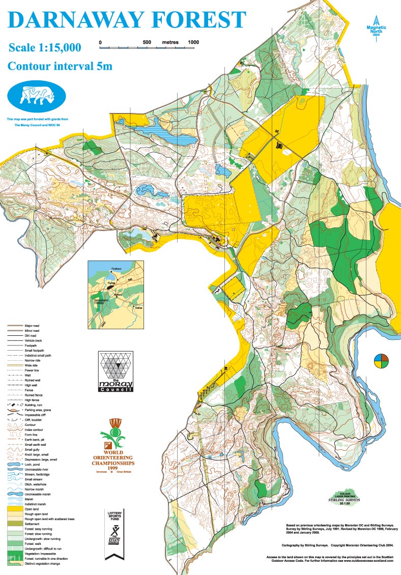
Darnaway map
Wednesday 5th August
Photo galleries: ActivNorth, Wendy Carlyle
Location

Nearest town: Brodie
- Postcode: IV36 2SW
- Lat/Lon: 57.59136,-3.68442
- Google Map
- Streetmap (OS)
- Bing Map (OS)
- OpenStreetMap
Darnaway is an extensive, well-managed forest with great variety.
Darnaway has been used for previous WOC and Scottish 6 Days events, including the first event in 1977. It has superb, varied forest on rolling terrain above the River Findhorn. The majority of the area is owned by Moray Estates, the estates and property of the Earl of Moray.
Organising clubs: Moravian Orienteers (MOR), Kingdom of Fife Orienteers (KFO), East Lothian Orienteers (ELO), with Octavian Droobers (OD)
Day Organisers: Liz Barr (MOR), Jane Halliday (MOR)
Planners: Lynne Walker (BASOC), Roos Eisma (TAY)
Assistant Controller: Bill Stevenson (ESOC)
Controller: Donald Grassie (MOR)
This day's competition will be the 13th event in the 2015 UK Orienteering League.
Travel: Please follow these travel directions to reach the event. There may be other possible routes but this is the route agreed with local police and other relevant official bodies.
From Inverness, follow A96 for 23 miles through Nairn and just beyond Brodie. Turn R onto minor road signed Whitemire/Conicavel. Follow O signs onto Estate tracks to parking field.
Distances between locations
Parking: In fields adjacent to Race Arena. A one-way system is in place, ensuring different entry and exit routes. Buses and campervans are in the same area.
Race Arena: A large open field, directly north of Darnaway Castle. The Arena is shared with WOC, but there is ample space for club tents.
Starts: 1km to White/Green Starts along private closed road and forest track, suitable for children’s buggies. Further 700m to Blue/Red Starts involving some taped sections off-track. Negligible climb to either start. A small number of toilets will be available on the route to the Starts.
Courses: All courses except those of TD1-3 (courses 1-4) are Middle Distance, with expected winning times of 30-35 minutes.
Map: Map updated by Deeside Orienteering and Leisure Maps (DOLM) and Stirling Surveys in 2015. The map will be at 1:7500 scale for all courses.
Terrain: Darnaway is a large, well-managed forest. There are areas of mature runnable beech forest and other areas containing denser mixed-variety trees. The terrain is rolling with some complex contour detail and intricate path networks.
String course: In the castle garden area adjacent to the Race Arena, on route to the Starts. The area contains some steep banks and the course is therefore not suitable for buggies. Due to conflicts between the String course and WOC athlete holding areas, the String course will be open for a reduced time on Day 3, from 09:30 to 13:30.
Safety Information: The area is bounded at the eastern end by the River Findhorn which lies within a steep gorge. The courses are planned to avoid the river. Darnaway Forest is sometimes used by other walkers, runners and horse-riders – please treat them all courteously.
Special Information: The day is shared with the WOC Relay event, ensuring plenty of interest and excitement, including a big screen within the Race Arena.
Exclusion area round family cemetery: There is an Out Of Bounds area, taped on the ground and shown on the start lane maps, but not on the competition maps.
[alternative keywords: final details, bulletin, day-3]
Darnaway map (Full size)

Darnaway Castle (Full size)