Day 1: Glen Tanar
Sunday 30th July
British Orienteering Ranking Points
Photo Gallery: Wendy Carlyle
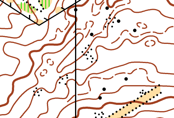
 Glen Tanar Competition Map
Since it was built as a traditional highland estate in 1869, Glen Tanar has been inviting people to relax and enjoy the great outdoors amidst a beautiful 25,000 acre landscape encompassing farmland, river, pine forests and heather clad moors.
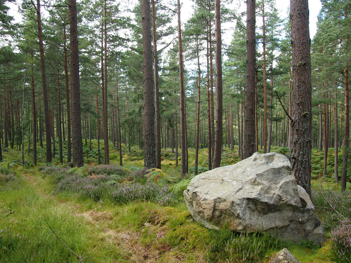
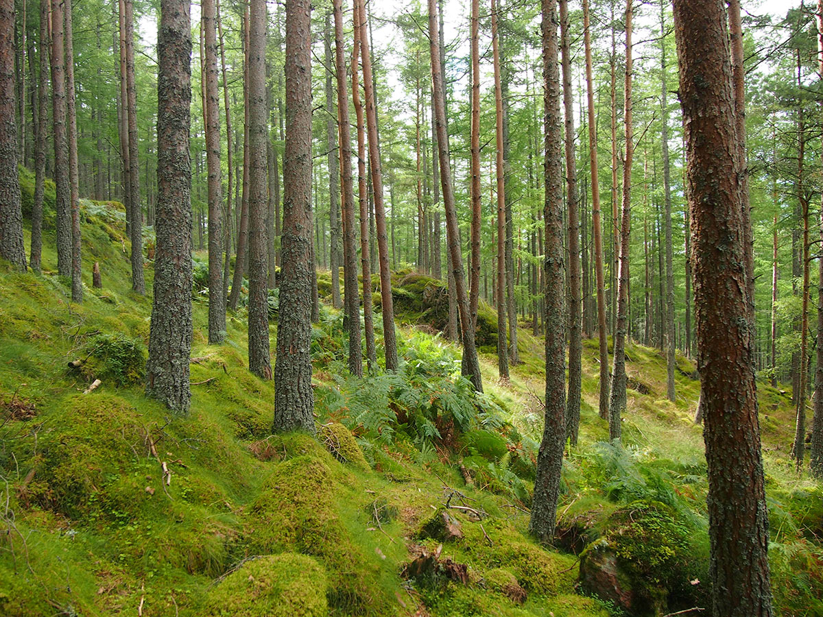
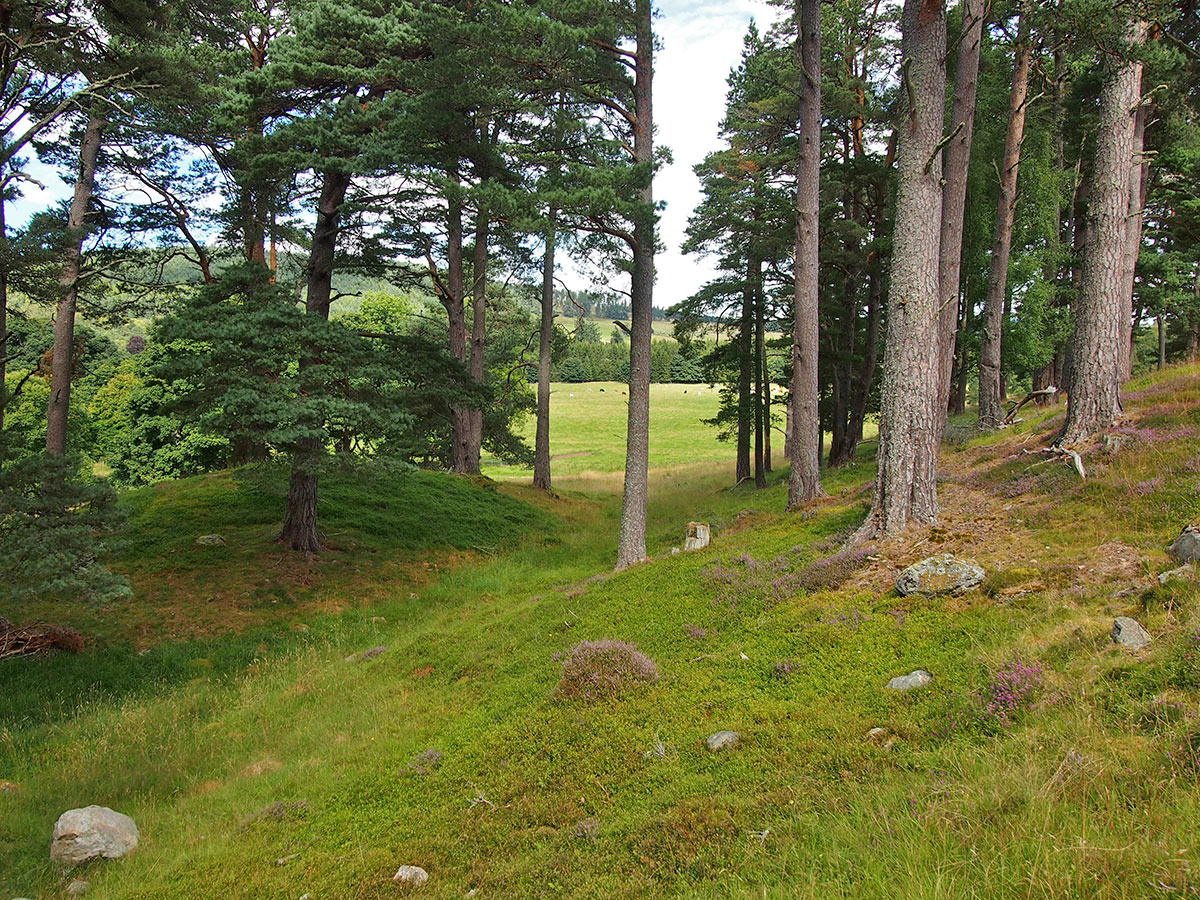
Glen Tanar was one of the first maps for Mar Orienteering Club, dating back to 1977. Previously used for the Scottish 6 Days in 1983 and 1993, more recently Glen Tanar was used to stage selection races for the World Orienteering Championships 2015. The Water of Tanar bounds the area to the north and west, with access to the previously unused parking area and race arena from the estate road by the Bridge o’Ess. A one-way traffic system will be in place, with no exit till the permitted time. There are very pleasant areas of mature Scots Pine plantation and larch on gently rolling slopes, but areas of steep and complex terrain including massive boulders and granite outcrops may also be encountered on the longer and more technical courses. There is good network of forest tracks and rides, though the number of smaller paths is limited and will force running through the terrain. Thanks go to the owners of the present Glen Tanar Estate for use of this lovely and popular area.
Organising Clubs: TAY, ESOC
Planners: Roos Eisma & Alastair Duguid (TAY), Mark Wood (ESOC)
Organisers: Davie Frame & Elaine Gillies (TAY)
Controllers: Ian Turner (SOLWAY), Ewart Scott (ESOC)
Directions: Follow signposted route from the A93 in Aboyne. At Aboyne Bridge turn right and follow the B976 2km to Bridge o’Ess. Do not approach along the B976 from the west, e.g. Dinnet, as the entrance is on a sharp bend. Temporary speed limit signs. Vehicles should exit left/west when leaving the event at the Bridge o’Ess (back onto the B976). Last arrival at 12:30. No exit before 13:00.
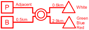
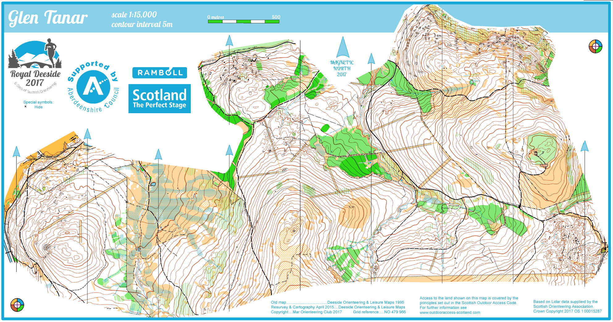
Parking: In a large flat field, 2.6 km along a rough estate track. Bus passengers take care crossing a minor public road and follow signs to the Arena.
Arena: In the same field as Parking. Starts: White: exit south. Unsuitable for buggies. Green/Blue/Red: exit northwest, passing the string course. Mostly on good paths/ tracks, with a short rougher section. There is a marshalled track crossing. Follow instructions and cross quickly to minimise traffic queues. There will be limited toilets near this start.
Maps: Deeside Orienteering and Leisure Maps (DOLM) resurveyed 2015, revised 2017. M/W21E 1:15,000, all others 1:10,000.
Terrain: Varies from steep hills with intricate contour detail on rocky moraine to sections of open forest. Distinct hills combined with variety in vegetation provide complex route choices on most courses. An open area, crossed by courses from the far start, is bordered by a barbed wire fence. This is crossable for many competitors but crossing points with lowered wire will be marked on the map.
String Course: Northwest of Arena. The start is accessible for buggies, but courses are not. The courses are beside a stream; please don’t allow unsupervised children to play in or near this.
Safety Information: Vehicles pass a marshalled pedestrian crossing on entry and exit. Please slow down and stop if requested. The estate is open to the public, including tracks used by competitors. Please be polite.
Elite Courses: Long distance; 80 min Estimated Leading Time (ELT).
Special Information: Day 1 queues to collect bibs and to Enter On the Day may be long; please allow time for this.