Day 4: Creag Choinnich
Thursday 3rd August
Split Times - WinSplits Online
British Orienteering Ranking Points
Photo Gallery: Wendy Carlyle
Beware Lyme disease!!
Remember to check for ticks after every run. For more information on how to remove ticks go to www.nhs.uk.
Tick bites can infect you with Lyme disease, which can be a very serious illness. If you feel unwell in the weeks after the event and/or develop a rash, be sure to consult a doctor.
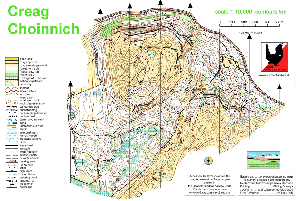
 Creag Coinnich Competition Map
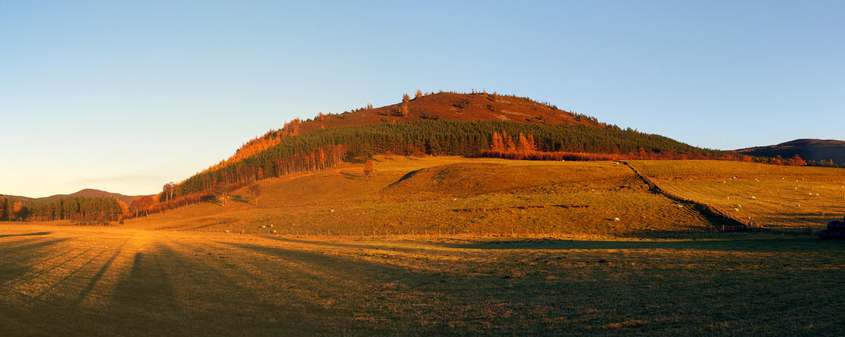
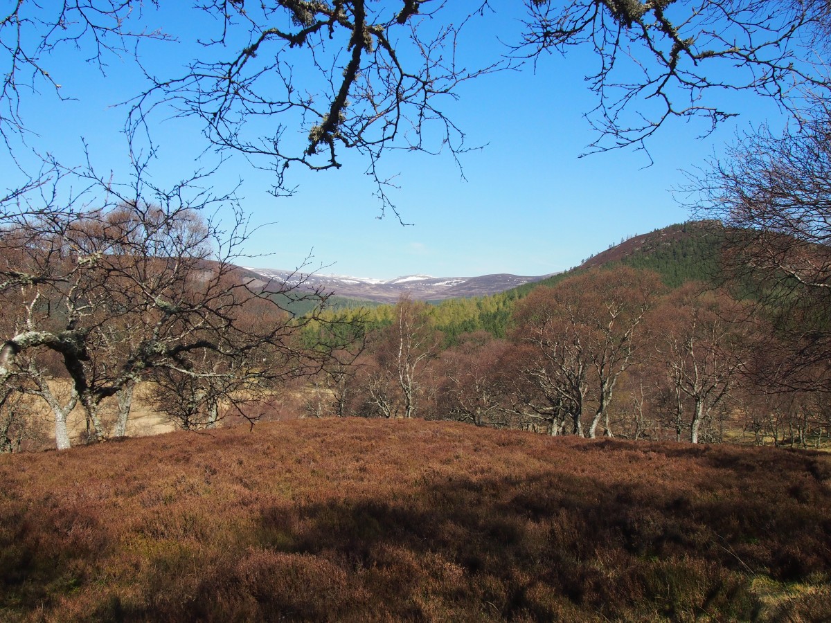
Creag Choinnich was used for the Scottish Relay Championships at the popular Jubilee Five multi-day event in 2012 and provided fast orienteering with some steep climbs. Creag Choinnich is described in the walkers’ guide as a “diminutive but beautiful little hill just east of Braemar, clothed in pinewoods.
Its ascent makes a short but very steep walk, which can easily be combined with the Lion's Face walk”. The area has been greatly extended, reaching nearly 690 metres at Carn na Sgliath, defined as a HuMP and a Graham and with superb views from the summit to much higher hills such as Lochnagar and Ben Avon. The new area is mostly very runnable with open moor and mature pine forest covering a steep slope – almost Swiss in feel. The area is immediately adjacent to Braemar, an attractive village well-known for the annual Highland Games attended by the Royal Family. Thanks are extended to the Invercauld Estate for use of this fine area.
Organising Clubs: BASOC, ECKO, EUOC, RR
Planners: Ross Lilley & Alan Partridge (ECKO)
Organisers: Pauline McAdam & Sarah McAdam (RR)
Controllers: Eddie Harwood (MOR), Andy Oliver (MAROC)
Directions: Access directly from the A93 north of Braemar. Temporary speed limit signs.
Parking: Very large flat field west side of the A93.
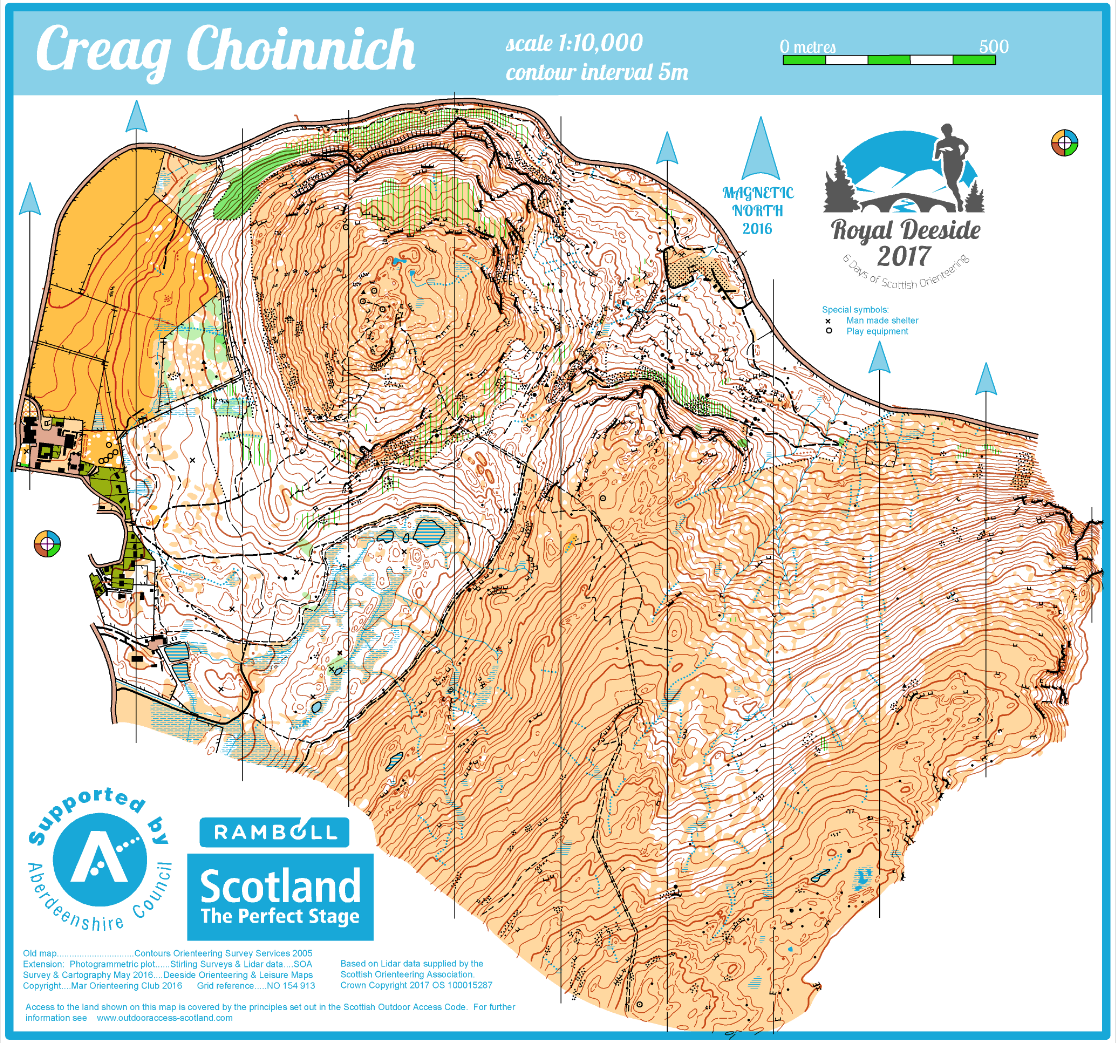
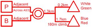
Arena: Field opposite parking, east of A93. Use manned crossing points to cross A93.
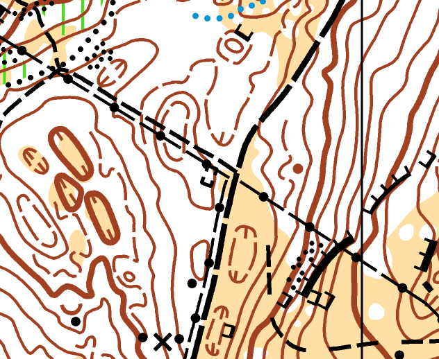
Starts: Shared route to all Starts through Braemar until 200 m before White/Green Start. Portable toilets will be located close to where routes to Starts diverge. From there the route to Red/Blue Start is mostly uphill and fairly physical. Allow plenty of time for this part of the route. The start is exposed - competitors may leave clothing at the Start but should note that it will not be returned to the Arena until after the Start closes.
Maps: DOLM surveyed and resurveyed 2016, 1:10,000
Terrain: The map covers Creag Choinnich and the slopes of Carn na Sgliath, highest point 690 m. The area is very varied with the wooded areas generally being good running but often very steep. Open areas tend to be much rougher. There is considerable contour and rock detail in areas, contrasted with slopes containing only subtle changes giving an even harder technical challenge made fair by the LIDAR based mapping. Shorter courses do not visit the rougher, higher or steepest parts.
String Course: Within the fenced-off area to the north of the Arena. Not suitable for buggies.
Safety Information: Creag Choinnich is bounded by the A93. The northern slope is very steep with huge crags. Courses avoid this area. Longer courses will encounter other areas of large crags. Competitors should not cross the high fences onto the A93 as this is an arterial route with fast-moving traffic. If lost, heading downhill east or west, should bring competitors to this fence or to Braemar. There are several uncrossable marshes. Competitors should be familiar with how these are mapped and should not attempt to cross one.
Elite courses: Long distance; 60 min ELT.
Special Information: There will be smiley faces used towards the end of junior courses to indicate correct routes.