Day 5: Glen Feardar
Friday 4th August
British Orienteering Ranking Points
Photo Galleries: Wendy Carlyle
Beware Lyme disease!!
Remember to check for ticks after every run. For more information on how to remove ticks go to www.nhs.uk.
Tick bites can infect you with Lyme disease, which can be a very serious illness. If you feel unwell in the weeks after the event and/or develop a rash, be sure to consult a doctor.
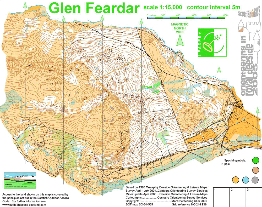
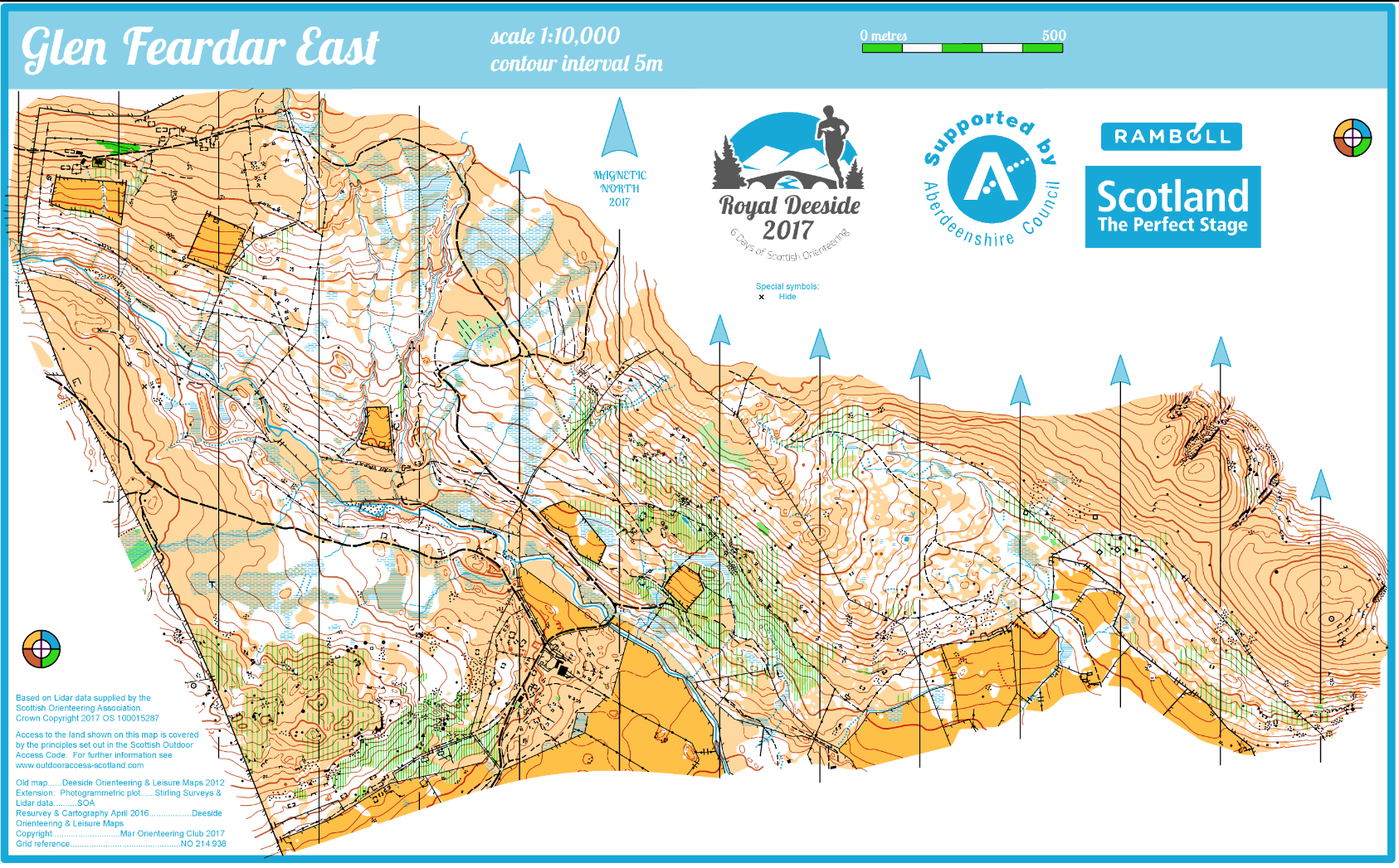 Glen Feardar East Map
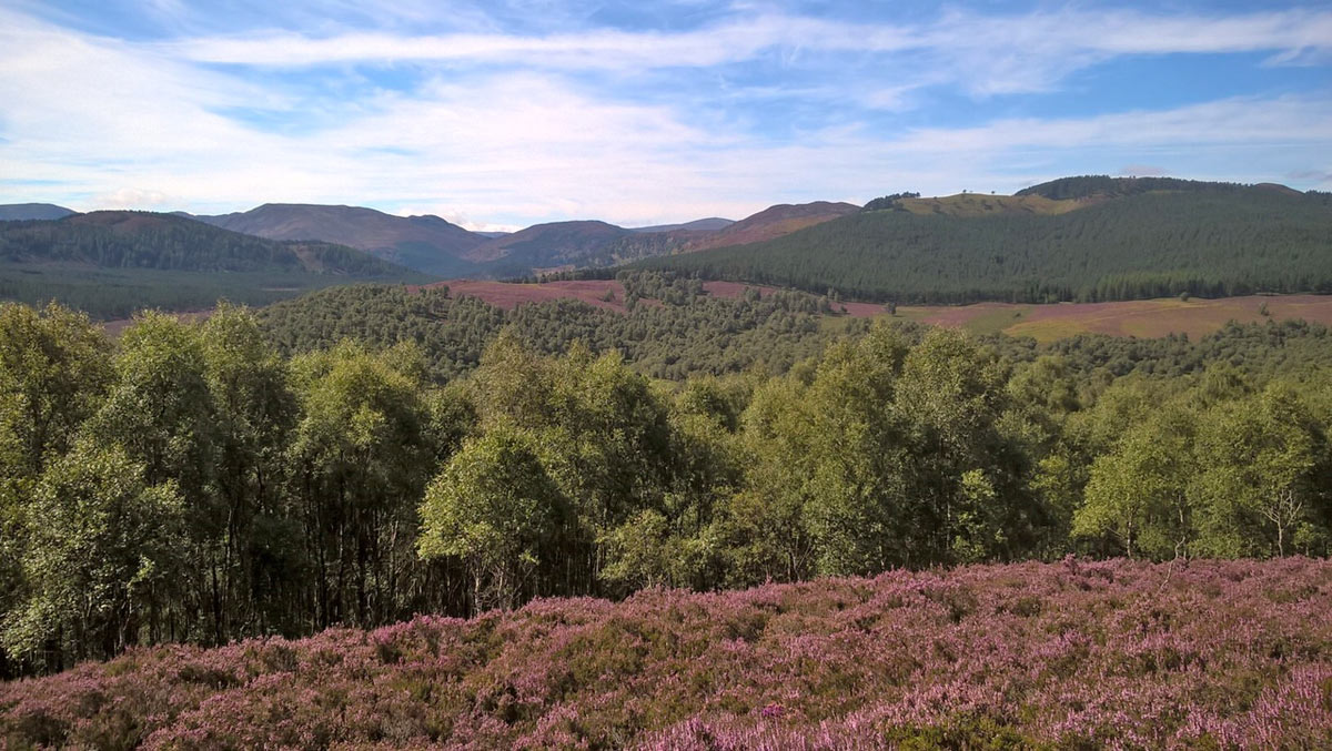
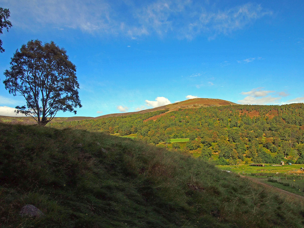
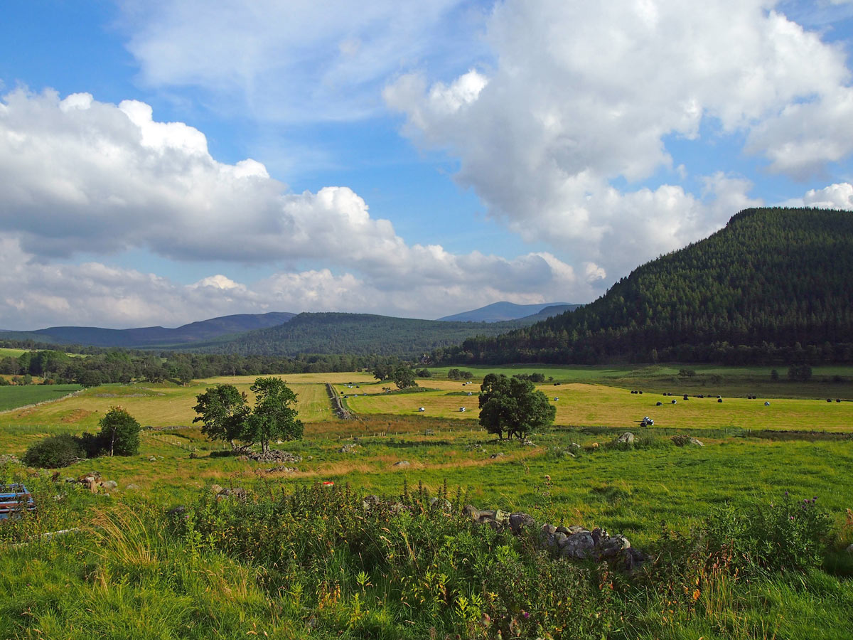
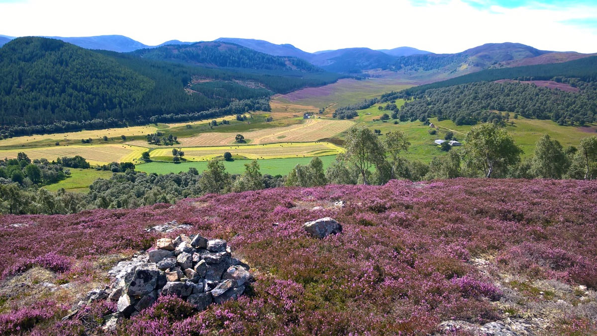
Glen Feardar (or Fearder) has been described as “tucked away in a ‘hidden valley’ just four kilometres west of Balmoral, Glen Feardar has that classic Deeside combination of open hillside, birch woodland, mature plantation and patchy natural pine forest. All with the added bonus of views that become increasingly spectacular the higher your course takes you”.
The area has supported many major events, including the Scottish 6 Days in 1993 and 2005 as well the Scottish Orienteering Championships during the Jubilee Five multi-day in 2012. Thanks go to Invercauld Estates, a sporting estate which covers approximately 43,600 hectares who derive their income from stalking, shooting, forestry, agriculture, tourism, fishing and let properties. For Royal Deeside 2017 the area has been extended towards Craig Nordie allowing us to stage the final two days from a shared race arena. The planners enthuse about the views to Balmoral, venue for the 2018 British Orienteering Championships, from the extended area. Glen Feardar will be accessed from the A93 at Inver, but a one-way traffic system will be in place, with no exit till the permitted time. With support from EventScotland, we hope to bring TV coverage of the final race including internet access for those unable to join us at the event.
Organising Clubs: MOR, AYROC, support from OD
Planners: Alan Halliday (MOR), Andrew Barr (MOR/EUOC)
Organisers: Roo Hornby (MOR), Andrew Campbell (MOR)
Controllers: David Kershaw (ESOC), Tim Griffin (GRAMP)
Directions: Signposted from A93 (Aberarder), 3.5 km west of Crathie. Temporary speed limit signs. Follow narrow road, then unpaved track (beware potholes) for 2 km. Last arrival at 12:30. No exit before 13:00. Bus Drop-off at A93 junction; follow 2 km pedestrian route, do NOT walk along vehicle route.
Parking: Flattish large field at end of track. Toilets and traders in Parking.
Arena: Adjacent field to Parking on steep slope with downhill Run-in. Field is tussocky and not easy for buggies.
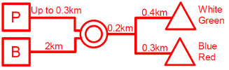
Starts: Two Start locations. All exit Arena to north-northeast around String Course and across river. White/Green continue up good track to east then north, 45m climb (separate White & Green Start Kites). Red/Blue turn right along river southeast then northeast, minimal climb. Limited portable toilets close to Starts.
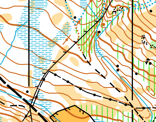
Maps: DOLM surveyed 2012, revised 2017, 1:10,000
Terrain: Hilly mix of plantation, natural pine/birch woodland, heather and fast open moor. Generally good visibility, with interesting contour and rock detail. All courses cross a river; if in spate, cross at mapped crossings. TD1-3 courses do cross at bridges.
String Course: Close to Arena in two fields; avoid abandoned farm machinery. Terrain rough in places; only suitable for hardy buggies.
Safety Information: This is a working farm with a ruined building and potentially hazardous farmyard materials. These will be marked OOB. If river and streams are in spate competitors are strongly advised to use marked crossing points. The Arena is exposed if weather is extreme. Only Vodafone mobile works in Arena.
Elite Courses: Middle distance; 35 min ELT. Terrain as for other courses.
Special Information: Bus passengers, please read Daily Newsletter for updates pedestrian route to Arena. The pedestrian route has changed and is now an easier and safer 20 min walk (1.5 km). Thank you to Forestry Commission Scotland for their assistance with this late change.