Day 2: Balfour Forest
Monday 31st July
Split Times - WinSplits Online
British Orienteering Ranking Points
Photo Gallery: Wendy Carlyle, Deeside Camera Club, Steve Rush
If anyone wants full-size high-resolution copies of Deeside Camera Club photographs with the copyright watermark removed, they can email: 6days at deesidecameraclub.org. There will be no charge but they suggest a donation is made to Braemar Mountain Rescue through mydonate: https://mydonate.bt.com/charities/braemarmountainrescue
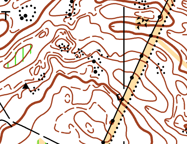
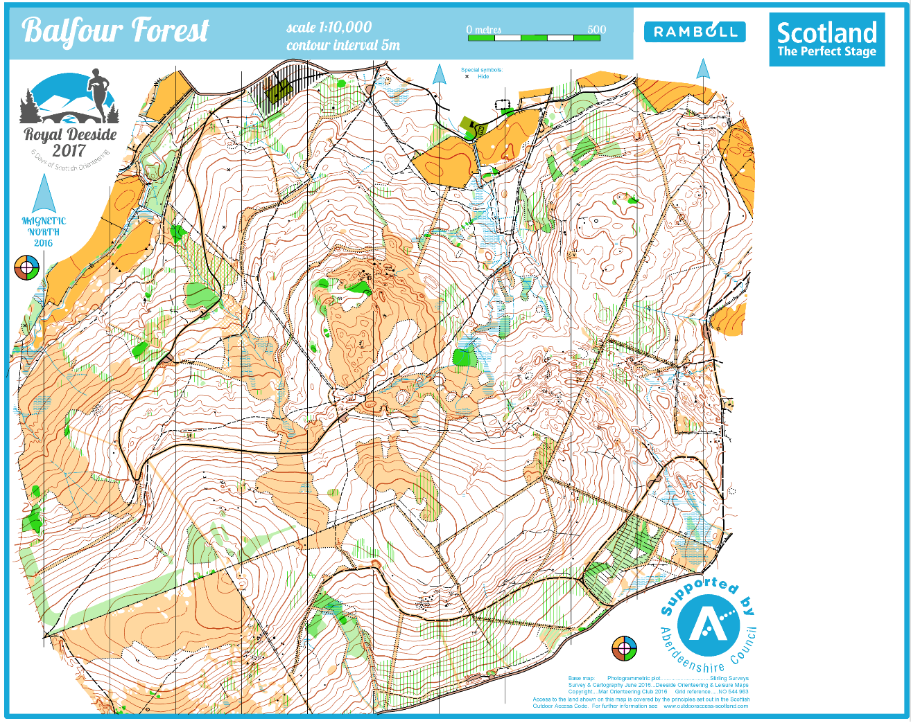 Balfour Forest Competition Map
Part of the extensive Forest of Birse, Balfour Forest is new to orienteering and shares some of the characteristics of nearby Glen Tanar, separated by the steeper and more complex terrain of Birsemore (Day 3).
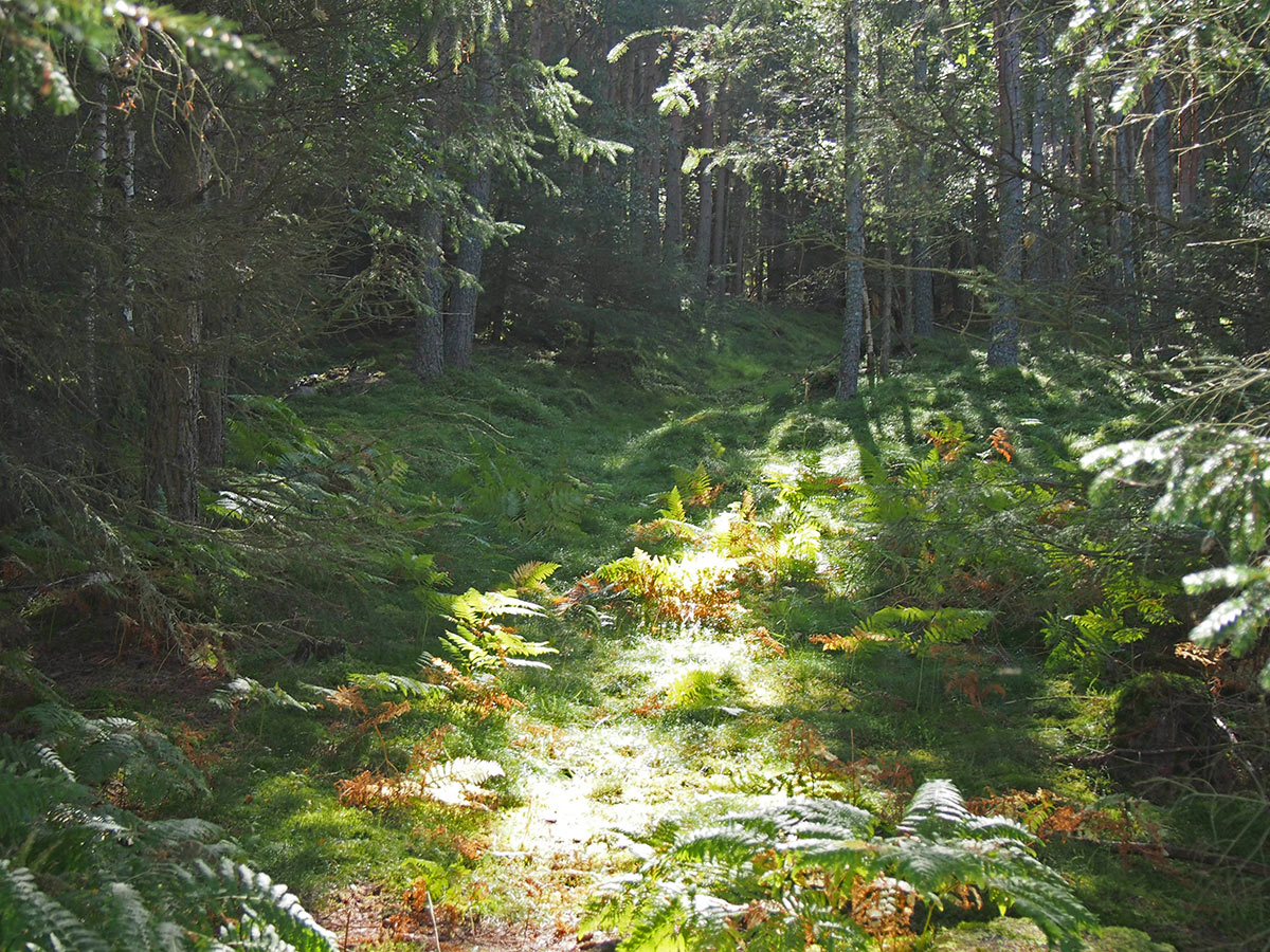
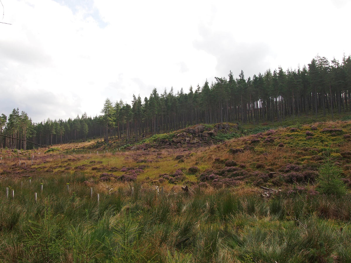
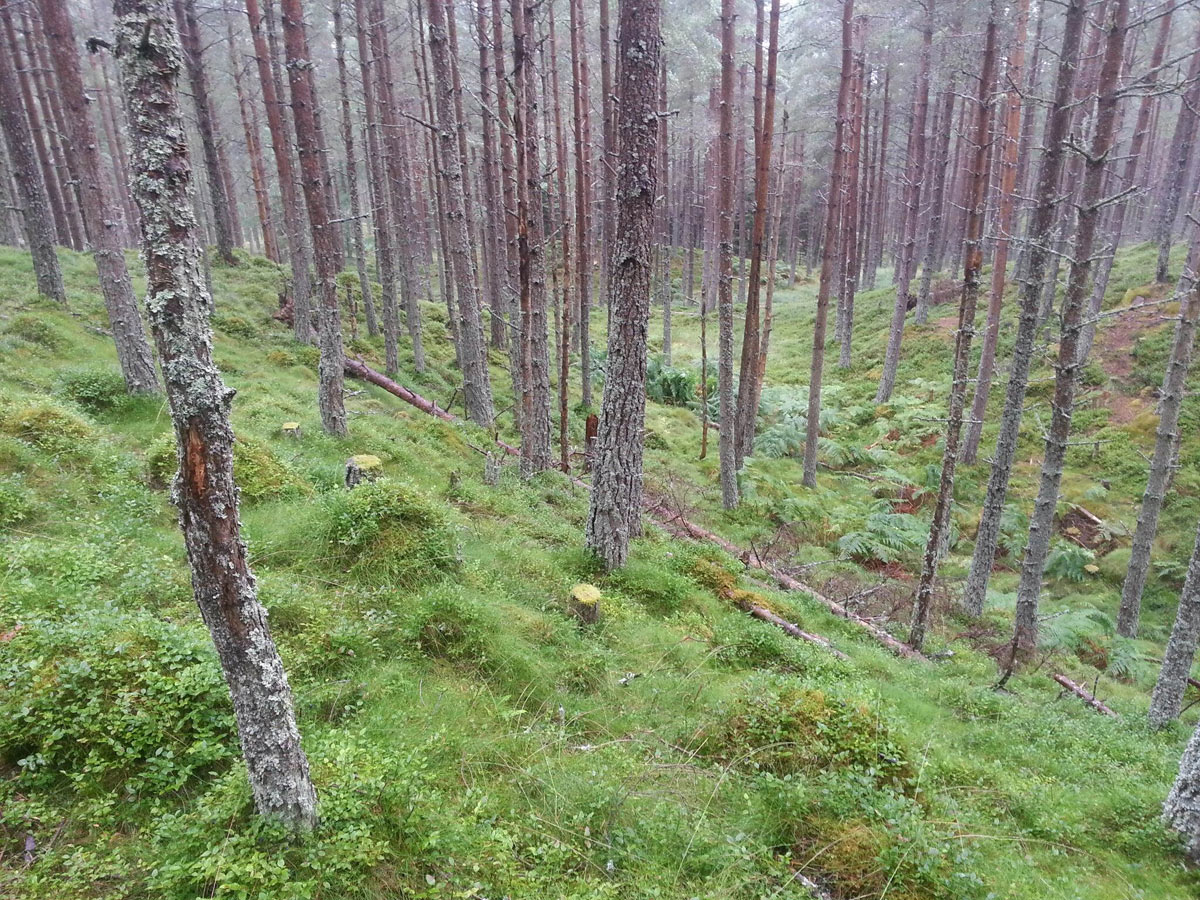
The area includes a good mix of different terrain types, ranging from fast open forest to rough open including small patches of moorland. There is a part described by the Controller as a “well contoured area”, with lots of potential control sites. The area offers classic orienteering with good opportunities to plan some true classic-distance style courses. Thanks go to the owners including the Birse Community Trust, Dunecht Estate, Ballogie Estate and Balfour Estate. The race arena and parking is shared with Day 3, with a one-way circuit clockwise around adjacent roads.
Organising Clubs: INVOC, KFO & SOLWAY
Planners: Iain Shepherd & Marsela McLeod (INVOC)
Organisers: John Emeleus (KFO) & Rhona Fraser (INVOC)
Controllers: Rob Hickling (GRAMP) & Tim O’Donoghue (SOLWAY)
Directions: Follow signposted route from the A93 in Aboyne. At Aboyne Bridge turn left along the B976 and follow for 4 km before turning sharp right onto one-way system on minor road through Oldyleiper. Follow for 2.4 km to Parking. Do not approach through Birsemore (exit only) or attempt short-cut signposted Birse Church. Exit northwest on one-way system.
Parking: In a large flat field immediately off the minor road.
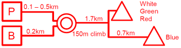
Arena: 100-500 m from Parking and 200 m from Bus Drop-off. Take care when crossing and walking alongside the public road. On approach to the Arena is a 40 m section which might be difficult for buggies. Please use access points provided for the event and do not cross the boundary fences anywhere else.
Starts: A common route to all starts leaves the Arena at its west corner. Initially on a mix of paths and rough ground in the forest (unsuitable for buggies) and then along wide forest roads. Portable toilets located at White/Green/Red start.
Maps: DOLM surveyed 2016, 1:10,000
Terrain: A new area to orienteering, includes a good mix of different terrain types, ranging from very fast open forest to slower rough open areas. Some boundary walls can be high and very difficult to cross in places and courses generally use crossing points or ruined parts of the higher walls.
String Course: Adjacent to the finish field, partly rough underfoot.
Safety Information: The final two controls are common for all courses and the leg between them follows a short narrow ride. Please be considerate of slower/faster competitors in this area.
Competitors on longer courses may encounter unmapped fences which can be a trip hazard. These are either adjacent to walls or ruined fences lying flat on the ground surrounding plantations (green on map).
Elite Courses: Long distance; 60 min ELT.